Site Location
Shepley Mill is located on the River Wandle (TQ 28278 65594) approximately 0.4 km north of Carshalton and 5 km west of Croydon, within the London Borough of Sutton. The mill itself may have been constructed in the early 15th century, as part of a large mill complex consisting of the “Water (leather) Mills” and “Hackbridge (snuff) Mills”, which were used in the production of leather and snuff (a smokeless tobacco made from ground or pulverised tobacco leaves.
The interactive content below might not be fully accessible.


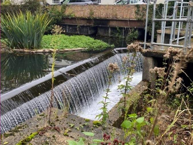
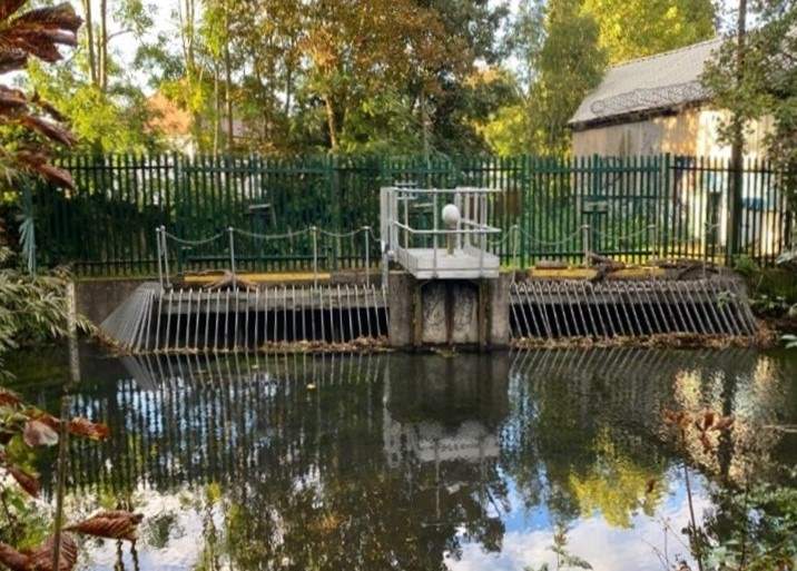
At the mill, two branches of the River Wandle, the Carshalton and Croydon, converge upon two weirs (East and West weirs) which discharge through separate culverts beneath the mill.
The west weir on the Carshalton branch, has a crest length of 14 m and is protected by a trash screen (owned by the Environment Agency), with a total width of 11.75 m consisting of 96 bars spaced at 0.16 m apart with a bar width of 0.02 m. The head drop across the structure is approximately 1.75 m (based on surveyed water levels) between the weir crest and concrete bed of the weir near the entrance to the culvert, which is a 1200 mm x 1200 mm square shaped concrete structure that forms part of the weir wall. The culvert is 64.8 m in length, with a head drop of approximately 0.3 m.
Although the majority of the River Wandle flow (approximately 95%) is from the Croydon branch; 60% of the flow is discharged over the west weir downstream into the River Wandle in response to the weir crest level being approximately 0.2 m lower than the east weir.
The interactive content below might not be fully accessible.
The east weir on the Croydon branch also has a crest length of 14 m, with the head drop across the structure approximately 1.4 m (based on surveyed water levels) between the top of weir crest (not the overspill weir) and bottom of the concrete bed, which leads into twin 1100 mm circular concrete pipes. The pipes, 3.5 m downstream, then converge into a single large 1200 mm circular concrete pipe, which then discharges flows downstream into the River Wandle. The total length of the culvert is 55.2 m, with an overall head drop of approximately 2 m and thus considerably steeper than west weir culvert.
The land lying to the east of the Causeway adjacent the Carshalton branch and Wilderness Island Local Nature Reserve (LNR) is owned by the London Borough of Sutton Council. Land adjacent the Croydon branch between Watermill House and the railway bridge is Registered Common Land. The west weir is owned by the Environment Agency, although ownership of the east weir is to be confirmed.
For migratory fish such as salmonids, which include Atlantic salmon and trout; the main limiting upstream passage factor through Shepley Mill are the aforementioned weir structures which are not passable for migratory fish due to the large head drops and potentially the culverts, which may not be hydraulically suited for migratory fish or potentially prone to blockage in particular the east weir culvert. There is also potential impassability for European eel, largely due to the lack of suitable climbing substrate and potentially high-water velocities both at the weirs and along the culverts. Downstream passage for migratory fish (e.g., kelts, smolts, multi spawners) may be limited by the steep plunging flows of the weirs, which may cause injury and mortality.